Zephyr drone is breaking records in the stratosphere
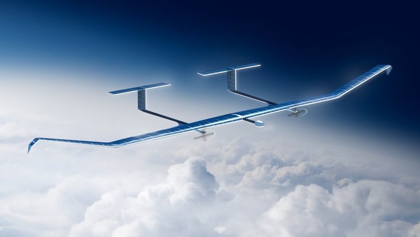
The solar-powered Zephyr drone, developed by the European multinational aerospace corporation Airbus, has soared to new heights, setting world records for endurance and altitude. This lightweight aircraft, weighing just 75 kg, is hand-launched and poised to revolutionize high-altitude, long-endurance flight, staying aloft for more than 2 months!
The Zephyr operates on an innovative day-night cycle:
- During the day, solar panels charge the batteries and power the propellers, allowing the UAV to ascend to 75,000 feet.
- At night, the batteries take over, and while the propellers slow down, the drone remains above 60,000 feet until sunrise.
The solar array is so efficient that it can recharge the batteries by lunchtime on most normal days, without requiring complete coverage of the wing surface.
Watch the incredible flight of the Zephyr on our YouTube channel!
After nearly two decades of development, the Zephyr is now being marketed for a range of critical applications:
- Earth observation
- Mobile phone base stations in the stratosphere
- Disaster relief communications
Functioning like a cell tower in the sky, the Zephyr can cover an area equivalent to 200 ground-based stations, eliminating the need for traditional infrastructure such as steel towers, fiber optics, and power lines.
Reaching the stratosphere is challenging, requiring the Zephyr to navigate various weather conditions during a 10-hour ascent. However, once it reaches the calm, clear air above 60,000 feet, it can maintain its altitude for months.
The Zephyr faces competition from other high-altitude platform stations (HAPS) and satellites, but its advantages include persistent earth observation and high-speed, 5G-like connectivity to mobile devices on the ground.
As the demand for reliable, high-speed connectivity grows, especially in remote and underserved areas, the Zephyr and similar HAPS could be instrumental in closing the digital divide. By providing a cost-effective alternative to traditional infrastructure, these UAVs have the potential to connect millions of people to the digital world.
The drone's capabilities in earth observation could be also invaluable for monitoring climate change, natural disasters, precision agriculture, and infrastructure management. Read how in situations where GPS navigation is unreliable or unavailable, QuData’s technology ensures UAV’s precise navigation and positioning, enabling the delivery of critical aid to previously unreachable locations.